What is bedrock?
Since some of the sites that you will see in the KMT System are exposures of Bedrock, let’s clarify what that means.
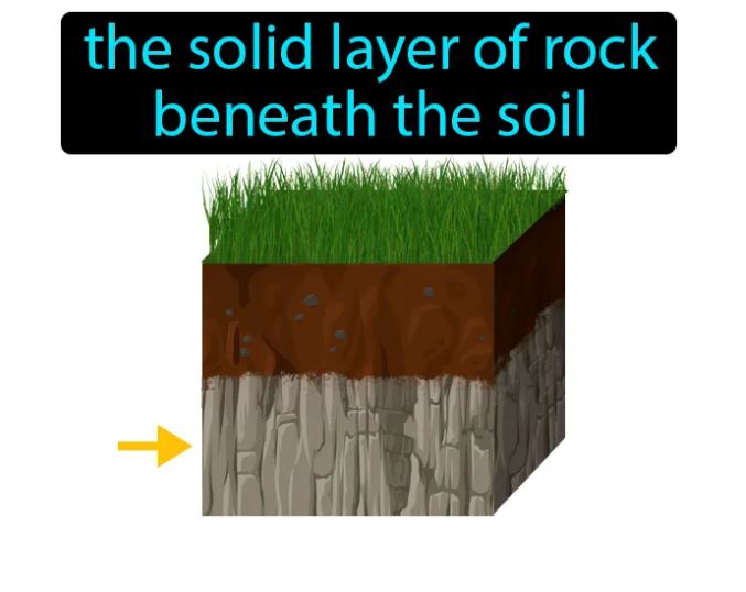

Bedrock is rock that is attached to the crust, Earth’s outermost surface layer. In Maine (and other glaciated areas) the glaciers picked up and deposited rock material long distances from their source. If the rock material is loose on the surface and if it is the same material as the underlying bedrock we call it “float”.
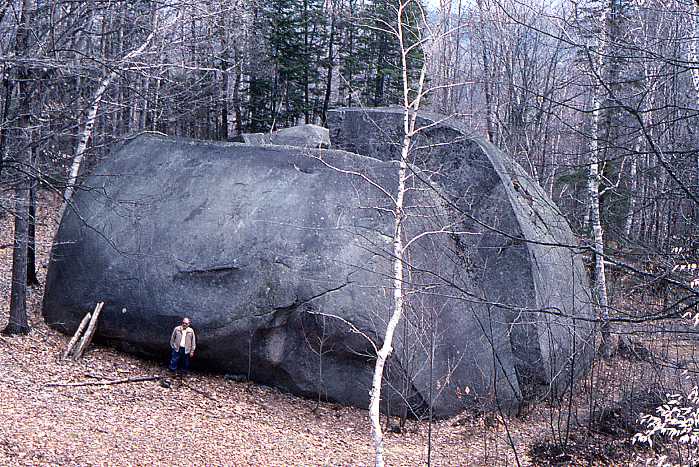
If the loose rock at the surface is larger than a cobble ( 2 ½ to 10 inches), different from the underlying bedrock, and likely transported by a glacier, then it is a glacial erratic. Daggett’s Rock at left and the boulders below do not “match” the underlying bedrock, indicating glacial transport. You can see glacial erratics deposited in areas all around the state.
Classic glacial erratics


Classic Glacial Erratics. Two of the above are along KMT Trails. One is not. Clues in the photos may tell you which one!